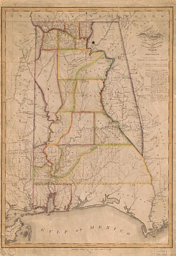
Alabama land records are key for genealogical research, especially due to early settlement patterns following Native American land cessions in the early 1800s. As a public land state, Alabama’s land was distributed through federal land offices, with records available via the Bureau of Land Management. Deeds, grants, and land patents reveal family names, migration trails, and economic status. These documents often predate statehood (1819) and can show how families moved into the Deep South. County-level deed books, many starting in the 1820s, may include transactions involving heirs, offering valuable clues to family relationships and transitions of property over generations.
Research your ancestors on MyHeritage
Government, Land, Court & Wills
Search historical records in the United StatesSearch historical records in the United States
- Alabama
- Alaska
- Arizona
- Arkansas
- California
- Colorado
- Connecticut
- Delaware
- District of Columbia
- Florida
- Georgia
- Hawaii
- Idaho
- Illinois
- Indiana
- Iowa
- Kansas
- Kentucky
- Louisiana
- Maine
- Maryland
- Massachusetts
- Michigan
- Minnesota
- Mississippi
- Missouri
- Montana
- Nebraska
- Nevada
- New Hampshire
- New Jersey
- New Mexico
- New York
- North Carolina
- North Dakota
- Ohio
- Oklahoma
- Oregon
- Pennsylvania
- Rhode Island
- South Carolina
- South Dakota
- Tennessee
- Texas
- Utah
- Vermont
- Virginia
- Washington
- West Virginia
- Wisconsin
- Wyoming


