Land records in England and Wales provide information about land-owning ancestors; there are a wide variety of these records, some of which are purely text based, such as land tax records and wills, whereas others include a helpful map, such as the Valuation Office survey and tithe maps. Using the sources below it is possible to discover what property and outbuildings were on your ancestor's land, and how the size of the land holding changed over time. By using all of the available sources for your ancestor's time, you can build a comprehensive picture of their land-owning activities. Not all of our ancestors were landowners and the majority of those named in historic land records are men. In some cases, occupiers of land are named alongside the land owners. We can use the below material to discover more about the plot on which they lived and worked during their lifetime.
Research your ancestors on MyHeritage
Title deedsTitle deeds

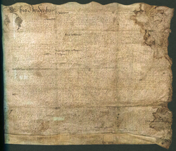
There are numerous types of title deeds available in England and Wales. These are written proof of conveyance of land and/or property. Some examples that can be discovered include:
- Final concord (feet of fines), a type of legal agreement used historically to confirm land ownership
- Common recovery, a legal proceeding in England that enabled lawyers to convert an entailed estate into absolute ownership
- Bargain and sale, a deed conveying real property without covenants
- Lease and release, a form of conveyance of real property
- Quitclaim, a formal renunciation of a right to land
- Mortgage
A majority of title deeds do not survive and many have yet to be catalogued by local archives. Others are held privately. If a title deed is available for an ancestor, it may contain information such as:
- Name, occupation and parish of buyer
- Name, occupation and parish of seller (vendor)
- Details of previous owners
- A map of the property's boundary
- A description of the location of the land or property
- A description of what is held within the land including outbuildings and geological features such as rivers
- Price and purchase conditions
Historically, title deeds were lengthy documents and are often written in Latin prior to 1733.[1] Later title deeds are more succinct.
Enclosure awards and mapsEnclosure awards and maps

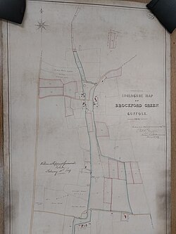
Prior to the field system we are used to seeing in the countryside today, the land in a parish used to be divided into strips. Until 1801, parishes could only undertake the enclosure system via an Act of Parliament[2] which was a complex process. After the General Enclosure Act of 1801[3] the system was simplified. It is therefore more likely to find surviving enclosure records from this date. Enclosure maps were created to show who owned each plot of land. Normally, a reference number is placed within a boundary and the accompanying enclosure award lists the names of the landowners along with the relevant plot number. You therefore need to see both the enclosure map and award to make sense of the record. They are usually held at county archives; however, they were not made for every parish in England and Wales. Properties are not always featured on enclosure maps, with the focus being very much on land ownership.
Tithe maps and apportionmentsTithe maps and apportionments

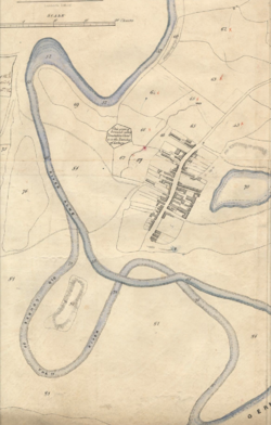
Tithes were a tax paid to the parish church and paid as one-tenth of the produce of a person’s land, such as paying 10% of their chicken's eggs or 10% of their cut timber. As this was a confusing procedure, The Tithe Commutation Act of 1836[4] created a new monetary system. Many parishes had already switched to a monetary system many years prior to the Act, but the maps formalised the matter and made sure that people were charged fairly. Apportionments are required to make sense of the tithe map, similar to enclosure maps needing the associated award, providing the names of the landowners and occupiers. The size of the plot is given along with a description, such as orchard or garden. Tithe maps do not exist for every parish and are not deemed to be wholly accurately drawn. They can be found at county archives and The National Archives.
Valuation office surveyValuation office survey
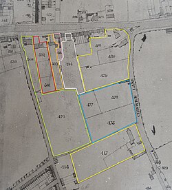
After the 1910 Finance Act, the Valuation Office survey was undertaken, otherwise known as the Lloyd George Domesday Survey.[5] or the Inland Revenue Survey. The records provide the names of the property owner and lead occupier, the house address, the number of rooms, the property’s estimated value and the amount of rent due. Note that only the head of the household is named so this record does not act as a full census substitute. Records are held at The National Archives.
Land tax recordsLand tax records
Land tax records tend to survive well for England and Wales and can be found dating back to 1692.[6] Initially only landowners were listed, but occupiers are named from 1772 onwards. Land tax records were used to prove a person's right to vote from 1780 so most survive from this date. The information included in a land tax record is:
- Name of proprietor
- Name of occupier (from 1772, may be the same person as the owner)
- The "sums assessed"
- The date
- The parish
There is rarely any extra detail that may help you to identify a person. In some cases, two men of the same name may be differentiated between using 'Jr' and 'Sr' pertaining to Junior and Senior, hinting they are father and son. Land tax records can be found at county archives and The National Archives.
Other sources of land ownershipOther sources of land ownership
Further to the above, you may discover more about your ancestor's land ownership by viewing the following:
- Wills— If your ancestor left a will they are likely to bequeath any land that they owed to a named person, usually a spouse or child. This land is usually detailed, including the names of any fields and any outbuildings or geographical features that can be found within the boundary.
- Estate records— Normally held within county archives, estate records retain information about both the landowning family and the tenants who rented their land or property. Documentation could include maps drawn to order, surveys, deeds and correspondence, such as letters describing the land.
- HM Land Registry— The national Land Registry was established in 1862 but it was not made compulsory to register a conveyance until 1899. From these dates, you may therefore find evidence of land ownership for a fee by applying to HM Land Registry.
- Manorial records— Names of land owners can be discovered in manorial court rolls, naming incoming and outgoing tenants, recently deceased land and property owners and relationships between parties. There are also manorial maps for certain manors naming land owners and showing their property boundaries. Manorial records tend not to survive very well in Wales.
- Court records—You may discover evidence of your ancestor's land ownership within civil or criminal court records, particularly if there was a dispute over who owned a piece of land.
- Newspapers— A person may be named in a newspaper article with regards to their land ownership. This may include a court write-up regarding a dispute, an accusation of poaching on their property or an advertisement for the selling or auctioning of land.
See alsoSee also
Explore more about land records in England and WalesExplore more about land records in England and Wales
- United Kingdom - Land & Property record collections at MyHeritage
- Land Records Solve Research Problems at Legacy Family Tree Webinars
- Research Guides- Land and Maps at The National Archives
References
- ↑ Introduction to deeds in depth. Manuscripts and Special Collections. University of Nottingham
- ↑ A Short History of Enclosure in Britain. The Land.
- ↑ 1801 Inclosure Consolidation Act. Wiltshire Council
- ↑ The History of Tithes. West End Local History Society
- ↑ The Lloyd George Domesday Survey. The Genealogist.
- ↑ Land Tax Redemption records. The National Archives

