Maps in Germany are essential resources for researching families of German descent. Since Germany has only existed as a modern nation-state since 1871, it may be necessary to seek out historical maps to properly pinpoint origins.
Border changes and different administrative structures are key elements to keep in mind. It is also important to consider the broader historical context, including social and economic developments. These significantly impacted migration and the movement of people within and beyond the borders of modern-day Germany.
Research your ancestors on MyHeritage
Historical ContextHistorical Context

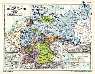
Prior to its unification in 1871, the area now known as Germany was made up of smaller states, including kingdoms (such as Prussia and Bavaria), principalities, and duchies. Their borders shifted frequently due to wars, treaties, and inheritances. The country was divided into West Germany and East Germany after World War II before being reunited in 1990.
When researching historical maps of Germany, especially for family history, it is important to consider former provinces and regions that are no longer part of present-day Germany. That includes East Prussia, West Prussia, and Posen. There are also regions settled by Germans that never formally became part of Germany, such as the Volga German ASSR in the Soviet Union and Transylvania in Romania.
In ancient times, a broad geographical area was called Germania and it was inhabited by Germanic, Celtic and Indo-European tribes. Much of this territory became part of the Holy Roman Empire. In medieval times, the majority of this land was controlled by Charlemagne.[1] Following the Protestant Reformation, German lands became divided into Protestant and Catholic strongholds, leading to religious tensions and the devastating Thirty Years War (1618-1648), which led to significant loss of life, widespread migration, and displacement. The Franco-Prussian War (1870-1871) was pivotal in the unification of Germany.[2] The First World War (1914-1918), and Second World War (1939-1945) led to societal upheaval, redefined borders, and a need for the creation of new maps.
Types of Maps in GermanyTypes of Maps in Germany

There are numerous types of maps that can be used to better understand the land and its shifting borders. These are some of the most common categories:
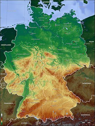
- Topographic maps (Topographische Karten): These are detailed representations of natural and man-made features, including elevation, bodies of water, forests, settlements, and transportation networks like roads and railways. They can be extremely helpful to learn about the type of land and what routes people may have taken during periods of migration.
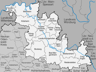
- Political maps (Politische Karten): These show administrative boundaries and national borders, including state, district, and municipal boundaries. They're crucial to understand jurisdictional areas and territorial changes and locating places within administrative context.
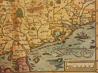
- Historical maps (Historische Karten): This broad category includes any maps that depict a past state of affairs. They might show historical borders of kingdoms, duchies, and empires (like the Holy Roman Empire, Prussia, or German Empire). In some cases, they may depict historical events like battle routes during times of war or migration paths.
- Cadastral maps (Liegenschaftskarten oder Flurkarten): These highly-detailed maps show individual land parcels, property boundaries, and plot numbers. They are useful for legal purposes and to show property ownership or land divisions, including how the land was divided over time.
- Gazetteers and Atlases (Ortsverzeichnisse und Atlanten): These geographical dictionaries are essential to locate specific places. They often contain an index of place names listed alphabetically and online versions like the Meyers Gazetteer makes it easier than ever to search them. Utilize historical atlases to see border changes over time.
- Genealogical Maps (Genealogische Karten): These modern compilations are specifically designed for family history research. They tend to overlay historical boundaries, like parish borders or old administrative districts, onto modern maps. They may show areas of origin for specific surnames or families.
Where to Find Maps of GermanyWhere to Find Maps of Germany

While some historical maps can only be found at libraries or archives in Germany, many of these collections and resources are now online. These are useful links to find maps in Germany:
- Meyers Gazetteer: One of the most well-known and widely used resources for genealogical research, it includes former territories like Prussia or Posen, making it especially useful. Keep in mind that the it depicts place names as they appeared during the German Empire (1871-1918) and that the names are in their German form. Wildcard searches can help find places of interest. This site provides administrative boundaries for each place to help with further research and even has an Ecclesiastical tab to find the appropriate parishes for German church records.
- Kartenmeister: This is another invaluable resource. It is focused on old territories that belonged to the eastern part of Germany, including Prussia and places located in modern-day Poland. It helps to identify administrative jurisdictions and links to Google Maps for the locations.
- Bundesamt für Kartographie und Geodesy (Federal Agency for Cartography and Geodesy): This official website from the German government includes geodata representations and topographic maps. Some of its holdings are not available for free, but the "Open Data" section includes free resources.
- State-Based Maps: Incredible resources have been digitized like the Bayern Atlas for Bavaria, Geoportal Hessen for Hessen, Brandenburgviewer for Brandenburg, and Geoportal Sachsen for Saxony.
- Political and Historical Maps: The best online collection of free political and historical maps is available at Wikimedia Commons. Another excellent resource is the David Rumsey Map Collection, which includes maps of both historical territories and modern-day German states.
- Cadastral Maps: These are less likely to be online due to privacy issues and the ongoing use of these maps. You may find them at a state-based geoportal, like those listed above, or you may need to consult archives in Germany.
Administrative StructureAdministrative Structure

It is important to familiarize yourself with the typical administrative structure for German lands, as this knowledge will help in finding relevant maps and records:
- Bundesländer (Federal States): This refers to the 16 modern-day states that comprise the federal republic of Germany. They include Baden-Württemberg, Bavaria, Hessen, Nordrhein-Westfalen, and Sachsen. A full list can be found here.
- Regierungsbezirk (Governmental District): This is a sub-division of a larger state. It helps to locate records from the 19th to 20th centuries.
- Kreis (District): This is a district and it is a fundamental level of local government that falls under a Bündeslander or Regierungsbezirk. it is similar to a county in other administrative systems.
- Landkreis (Rural District): This is a rural district that comprises of multiple municipalities.
- Gemeinde (Municipality): This is a municipality. It may be a town, village, or collection of small villages. Every part of Germany belongs to a Gemeinde.
- Provinz (Province): A major administrative division that is found in older territories such as the Kingdom of Prussia. Historical maps and some genealogical records may be at the Provinz level.
- Kirchspiel (Parish): An ecclesiastical district served by a particular church. Prior to civil records becoming more common in the 1870s, these were the main sources for records of birth, marriage, and death.
See alsoSee also
Explore more about Maps in GermanyExplore more about Maps in Germany
- A la Karte: Borders, Maps and Gazetteers for German Genealogists by James M. Beidler on Legacy Family Tree Webinars
- Germany - top ethnicities from MyHeritage DNA
- Mapping for Research Success by Kimball Carter on Legacy Family Tree Webinars
- Luther, Napoleon and the Kaiser – German History for Genealogists by Ursula C. Krause on Legacy Family Tree Webinars
References
- ↑ Charlemagne of Germany. Encyclopedia Britannica.https://www.britannica.com/place/Germany/Charlemagne
- ↑ Treaty of Frankfurt ends Franco-Prussian War. History.com.https://www.history.com/this-day-in-history/may-10/treaty-of-frankfurt-am-main-ends-franco-prussian-war

